Vladivostok—Moscow Travel Report: Route and Photo Analytics
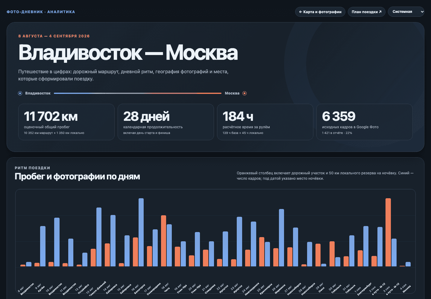
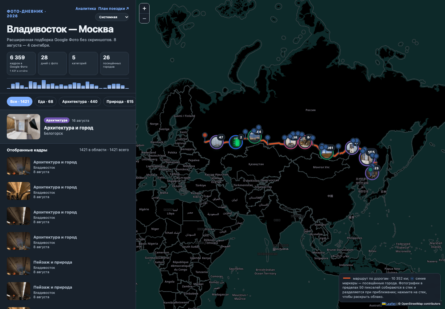
This project turns a month-long road trip from Vladivostok to Moscow into an interactive data story. The public report combines a road-following map, a curated Google Photos archive, daily mileage, driving-time estimates, regional geography, city-level statistics, content categories, and a catalogue of landmarks into one coherent visual narrative.
From photo archive to structured dataset
The source archive contained 6,359 Google Photos images. A reviewable processing pipeline filtered screenshots and private material, upgraded selected files to web-optimized originals, extracted EXIF coordinates, and documented every fallback used when an image had time or place context but no exact GPS data. The published report contains 1,421 curated photographs across 28 days.
Interactive route and photo map
The main interface combines a Leaflet map with a road geometry built from OSRM and OpenStreetMap data. The route covers approximately 11,702 km, 26 visited cities, and 21 regions. Photo markers are clustered by location and expand into visual clouds; filters separate nature, architecture, food, transport, and culture while preserving chronological context.
Analytical infographic
A companion analytics view summarizes the trip through key indicators and charts: estimated mileage, 184 hours behind the wheel, daily distance, photo volume, overnight points, regions crossed, city coverage, category mix, shooting peaks, and notable places. The result works both as a travel memory and as an auditable analytical report.
Data quality and privacy
Coordinate repair is conservative and traceable. Exact EXIF GPS is preferred; time-nearest and location-level placements are explicitly marked and backed by audit files. Personal and unsuitable images are excluded from the public collection without modifying the original Google Photos archive.
Delivery
The report is a lightweight static application served by Nginx in Docker behind Traefik. Map tiles use a same-origin proxy with caching and fallback, while immutable photo assets and a health endpoint make the project reliable to deploy and easy to maintain.
Value
The project demonstrates how an unstructured personal media archive can become a clear, interactive infographic: raw photos and coordinates are transformed into route intelligence, visual storytelling, and a navigable record of a complex journey.
Media Gallery